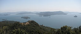
 Seto Sea Islands Seto Sea Islands
What is an island? Well, according to Wikipedia the answer
is, an island or isle is a piece of land, distinct from
a continent, completely surrounded by water. A Google
search for the answer to this question further simplified
the definition, stating that an island is simply, a
piece of land surrounded by water. Either way, this was
the criteria for estimating the total number of islands in
the Seto Sea of Japan.
The number of islands in the Seto Sea is estimated to be somewhere
between 700 and 3,000 islands....quite a range. This most
likely takes
into account even small groupings of rocks. For the purposes
of this website, an island was only considered to be an
island if it had a name when viewed on Google maps. I
searched for a couple of weeks in putting this Seto Sea
islands list together. While searching for islands, I came
across hundreds of really small rock islands that are
undoubtedly being included in the upper estimate range of
3,000 islands. I came up with a total of only 561
islands that had names which makes the 700 total islands estimate
seem much more believable. There is no doubt I
probably missed a few islands. If you happen to find
islands not on the list, please
message me at Facebook
with the information. Thanks. Anyway, the following is the
list of Seto Sea islands separated by region and then
prefecture. Click the links for a list of islands for each
prefecture. |
|
|
|
|
|
|
|
|
|
|
Chūgoku Region |
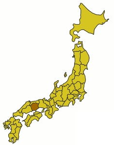 Okayama Prefecture
Islands Okayama Prefecture
Islands
Okayama Prefecture, in the southern part of Japan’s Honshu
island, is known for its mostly rural landscapes, feudal
castles and several notable art museums. It’s also a gateway
to Shikoku Island via Seto Ohashi Bridge. The capital,
Okayama City, is home to Korakuen, a formal garden completed
in 1700, and 16th-century Okayama Castle, also dubbed the
“Raven Castle” for its distinctive black exterior.
Seto Sea islands in Okayama prefecture
Google Map
- a map of the land area and islands of Okayama prefecture (new
tab) |
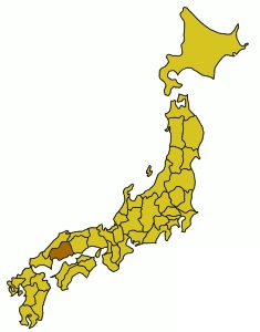 Hiroshima Prefecture
Islands Hiroshima Prefecture
Islands
Hiroshima prefecture, on Japan’s main island Honshu, is
bordered by the Seto Inland Sea to the south and the Chūgoku
mountains in the northwest. The capital, also called
Hiroshima, is a modern city known for its Peace Memorial
Park and Genbaku Dome, the surviving ruins from the only
area building still standing after World War II's 1945
atomic bombing.
Seto Sea islands in Hiroshima prefecture
Google Map
- a map of the land area and islands of Hiroshima prefecture (new
tab) |
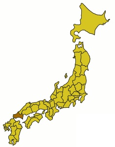 Yamaguchi Prefecture
Islands Yamaguchi Prefecture
Islands
Yamaguchi is a prefecture in Japan's Chugoku region, on the
southwest side of Honshu Island. The capital city, also
called Yamaguchi, dates to the 14th century, when a lord
designed it to look like "The Kyoto of the West." The
pagoda-topped Rurikō-ji Temple is in Kozan Park, nearby the
burial site of the Mori family, who ruled during the Edo
Period.
Seto Sea islands in Yamaguchi prefecture
Google Map
- a map of the land area and islands of Yamaguchi prefecture (new
tab) |
|
Kyūshū Region |
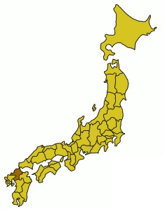 Fukuoka Prefecture
Islands Fukuoka Prefecture
Islands
Fukuoka is a prefecture on Japan’s main island of Kyushu
whose capital, Fukuoka city, was formed from a castle town.
Edo-period fortress ruins can still be seen among Maizuru
Park’s cherry blossoms. Modern-day Fukuoka is also known for
its elaborate float races during Hakata Gion Yamakasa
festival, and for its open-air food stalls, or yatai,
selling specialties such as yakitori chicken skewers.
Seto Sea islands in Fukuoka prefecture
Google Map
- a map of the land area and islands of Fukuoka prefecture (new
tab) |
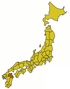 Ōita Prefecture
Islands Ōita Prefecture
Islands
Oita is a coastal prefecture on Japan’s Kyushu Island. It's
best known for its onsen (hot springs), including popular
Beppu. Its famous “Hells of Beppu” are 8 steaming thermal
pools, including Chinoike Jigoku, with red water, and
Tatsumaki Jigoku, featuring a geyser. Nearby Yufuin, another
hot springs town, lies at the foot of twin-peaked Mt. Yufu,
a 1,583m-high hiking and climbing destination.
Seto Sea islands in Oita prefecture
Google Map
- a map of the land area and islands of Oita prefecture (new
tab) |
|
Shikoku Region |
|
|
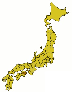 Tokushima Prefecture
Islands Tokushima Prefecture
Islands
Tokushima Prefecture, on the eastern end of Japan’s Shikoku
Island, is linked by bridge to mainland Honshu. It’s the
traditional starting point of an island-wide pilgrimage
route, which stretches 1,200km and encompasses 88 Buddhist
temples (more than a quarter of them in Tokushima). The
prefecture's remote Iya Valley, part of Tsurugisan
Quasi-National Park, has steep gorges, river rapids and vine
suspension bridges.
Seto Sea islands in Tokushima prefecture
Google Map
- a map of the land area and islands of Tokushima prefecture (new
tab) |
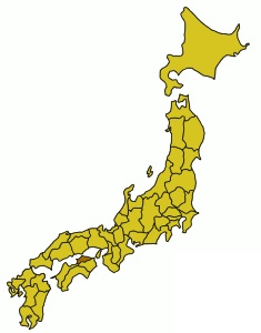 Kagawa Prefecture
Islands Kagawa Prefecture
Islands
Kagawa is a Japanese prefecture in the northeast of Shikoku
Island, between the Sanuki Mountains in the south and the
island-dotted Seto Inland Sea in the north. It’s the end
point of the Shikoku Pilgrimage route, which passes 88
Buddhist temples. The capital, Takamatsu, is a port city
home to the feudal Takamatsu Castle and Ritsurin Garden, a
landscaped park built in the Edo period, with koi ponds and
a teahouse.
Seto Sea islands in Kagawa prefecture
Google Map
- a map of the land area and islands of Kagawa prefecture (new
tab) |
 Ehime Prefecture
Islands Ehime Prefecture
Islands
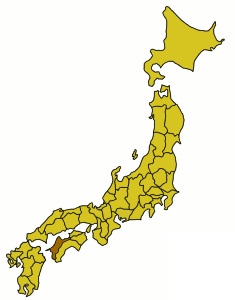
Ehime is a Japanese prefecture covering the northwest
quarter of Shikoku Island and dozens of smaller islands in
the Seto Inland Sea. In Matsuyama, the prefectural capital,
a cable car and chairlift rise to Matsuyama Castle.
Established in the 1600s, the castle is set on a plateau in
verdant grounds. Dogo Onsen is one of Japan’s oldest hot
springs, with a spa resort centered on its 19th-century
public bathhouse.
Seto Sea islands in Ehime prefecture
Google Map
- a map of the land area and islands of Ehime prefecture (new
tab) |
|
Kansai Region |
 Hyōgo
Prefecture Islands Hyōgo
Prefecture Islands
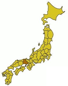
Hyōgo is a Japanese prefecture in the Kansai region of the
country’s main island, Honshu. Kobe, the prefectural
capital, is a cosmopolitan port city framed by mountains,
west of Osaka and Kyoto. It has a busy Chinatown and an
animated entertainment district around Sannomiya Station.
Kobe Harborland offers upscale shops and waterfront views,
while local steakhouses specialize in the area's signature
Kobe beef.
Seto Sea islands in Hyōgo prefecture
Google Map
- a map of the land area and islands of Hyōgo prefecture (new
tab) |
 Wakayama Prefecture
Islands Wakayama Prefecture
Islands
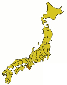
Wakayama is a Japanese prefecture in the Kansai region, on
Honshū island's Kii Peninsula. Its namesake capital is home
to Wakayama Castle, an Edo-period replica set in a hilltop
park with city views. Pilgrimage routes connect a trio of
Shinto shrines collectively known as Kumano Sanzan. More
than 100 temples rest among the peaks of Mount Kōya, where
Shingon Buddhism is headquartered.
Seto Sea islands in Wakayama prefecture
Google Map
- a map of the land area and islands of Wakayama prefecture (new
tab) |
 Osaka Prefecture
Islands Osaka Prefecture
Islands
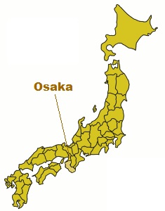
Osaka Prefecture is a prefecture of Japan located in the
Kansai region of Honshu. Osaka Prefecture has a population
of 8,778,035 and has a geographic area of 1,905 square
kilometers.
Seto Sea islands in Osaka prefecture
Google Map
- a map of the land area and islands of Osaka prefecture (new
tab) |
|
|
|
|
|
|
|
|